The nearest airport to Sunriver is Redmond Municipal Airport (RDM), served by five airlines. Rome2rio puts it 33.2 road miles and about 41 minutes from Sunriver Resort. Drivers come in on Highway 97, then turn off for Three Rivers and Chief Paulina Drive, a shared dirt road. In winter, Oregon's chain law applies on every highway, and TripCheck shows the passes before you leave.
Updated October 2026 · First published October 2026
Getting to Sunriver at a glance: the airport, the highways and the house
Highway 97 passes by Sunriver, about fifteen miles south of Bend, and the house is in the Three Rivers area near Sunriver. The figures below come from the airport, Wikipedia and Rome2rio. Road miles and drive times are Rome2rio's figures to Sunriver, or from the Redmond airport to Sunriver Resort. The house is about ten minutes from Sunriver Resort.
| Item | Figure |
|---|---|
| Nearest commercial airport | Redmond Municipal Airport (RDM), 18 miles north of Bend |
| Airlines at RDM | Five: Alaska, American, Breeze, Delta, United |
| Redmond airport to Sunriver Resort | 33.2 road miles, about 41 minutes |
| Portland to Sunriver | 175.8 road miles, about 3 hours 54 minutes |
| Seattle to Sunriver | 341.6 road miles, about 6 hours 44 minutes |
| Eugene to Sunriver | 125.2 road miles, about 2 hours 43 minutes |
| Boise to Sunriver | 328.5 road miles, about 7 hours 10 minutes |
| House to Sunriver Resort | Five miles, about ten minutes |
| House to Bend or Mt. Bachelor | About 30 minutes |
| Check-in | After 4:00 PM |
| Parking at the house | Up to 15 vehicles |
Flying to Sunriver: Redmond Municipal Airport (RDM) and its airlines
Redmond Municipal Airport, code RDM, is the main commercial airport in Central Oregon and the only one in the region with scheduled passenger service. Wikipedia places it 18 miles north of Bend. The airport's own site lists five air carriers: Alaska, American, Breeze, Delta and United. Its administration office is at 2522 SE Jesse Butler Circle, Suite 17, Redmond, OR 97756.
| Airline | Nonstop cities |
|---|---|
| Alaska | Burbank, Los Angeles, Portland, San Diego, San Francisco, Seattle |
| American | Phoenix, Dallas-Fort Worth |
| Breeze | Las Vegas |
| Delta | Seattle, Salt Lake City |
| United | Denver, Los Angeles, San Francisco |
From the airport, Highway 97 runs south through Redmond and Bend to Sunriver. Rome2rio puts the drive from the airport to Sunriver Resort at 33.2 road miles and about 41 minutes. Times change with traffic and weather, so check your map app on the day.
Sunriver also has its own airfield. Sunriver Airport (S21) is a public-use general aviation field owned by Sunriver Resort, with a 5,455-foot asphalt runway at 4,164 feet. Its Wikipedia entry lists no scheduled airline service. In its last published count, from 2010, traffic was mostly general aviation with some air taxi. Ticketed flights use Redmond.
Driving to Sunriver from Portland: Highway 26 over Mount Hood, or Highway 22 and Santiam Pass
Rome2rio puts Portland 175.8 road miles and about 3 hours 54 minutes from Sunriver, and there are two mountain routes. The first is U.S. 26 over Mount Hood. It leaves Portland on Powell Boulevard through Gresham, runs southeast to Sandy, then follows the historic Barlow Road to Government Camp. Government Camp sits at 3,891 feet in the Mount Hood Corridor and averages 232.5 inches of snow a year.
A few miles east of Government Camp, U.S. 26 meets Highway 35 at an interchange, then crosses Wapinitia Pass and Blue Box Pass. It runs through the Warm Springs Reservation to Madras. At Madras it joins U.S. 97. From there you go south through Terrebonne, Redmond and Bend to the Sunriver exits.
The second route uses I-5 south to Salem, then Highway 22 east. Highway 22 follows the North Santiam River through Mill City, Gates and Detroit to Santiam Junction. There it meets U.S. 20, which crosses Santiam Pass at 4,817 feet and continues through Sisters to Bend. Santiam Pass gets about 450 inches of snow a year, so in winter check both routes on TripCheck before you choose.
Driving to Sunriver from Seattle: I-5 to Portland, then over the Cascades
Rome2rio puts Seattle 341.6 road miles and about 6 hours 44 minutes from Sunriver, and the first leg is Interstate 5. I-5 runs south through Tacoma and Olympia to Vancouver, Washington; it covers 277 miles across that state in total. It then crosses the Columbia River on the Interstate Bridge into Portland.
From Portland the choices are the ones above. Take U.S. 26 over Mount Hood to Madras, or I-5 to Salem and Highway 22 to Santiam Pass. Both end on U.S. 97 heading south through Bend. The winter guide covers what the season looks like once you arrive.
Driving to Sunriver from Eugene: Highway 58 and Willamette Pass
Rome2rio puts Eugene 125.2 road miles and about 2 hours 43 minutes from Sunriver, most of it on Oregon Route 58. Highway 58 begins at an interchange with I-5 near Goshen, between Eugene and Creswell. It runs 86.75 miles southeast past Dexter Lake and Lookout Point Lake, through Westfir and Oakridge, and over the Cascades at Willamette Pass.
Willamette Pass is 5,128 feet high, and the Willamette Pass Resort ski area sits above the road. Highway 58 ends at U.S. 97 near Chemult. From there, U.S. 97 runs north through La Pine to the Sunriver exits. Highway 58 is also a popular alternate route for trucks when I-5 closes at Siskiyou Summit in winter.
The McKenzie River route, Highway 126, is the other way east from Eugene. It follows the McKenzie River, turns north at Belknap Springs past Clear Lake, and joins U.S. 20 for Santiam Pass and Sisters. The old McKenzie Pass road, Highway 242, is not plowed in winter.
Driving to Sunriver from Boise: U.S. 20 across eastern Oregon
Rome2rio puts Boise 328.5 road miles and about 7 hours 10 minutes from Sunriver, and U.S. 20 does most of the work. U.S. 20 crosses the Idaho line east of Nyssa, follows Highway 201 north to Cairo Junction, then runs west with U.S. 26 to Vale. From Vale it continues through Juntura to Burns, sharing the road with U.S. 395 through Burns and Hines. West of Hines it runs through Riley and Brothers to Bend.
The eastern stretch crosses three summits: Vines Hill at 2,886 feet, Drinkwater Pass at 4,212 feet and Stinkingwater Pass at 4,848 feet. U.S. 20 covers 451.25 miles in Oregon. In Bend it meets U.S. 97, which runs south to Sunriver.
Highway 97 to Three Rivers: the Sunriver exits and Chief Paulina Drive
Every route ends on U.S. 97, the north-south highway through Central Oregon. Through Bend it runs as the Bend Parkway, an expressway with full interchanges. The stretch from U.S. 20 to north of Cooley Road moved onto a new alignment in August 2024. South of Bend it is an expressway past Sunriver, with a four-lane section through Newberry National Volcanic Monument that opened in 2011. The Sunriver interchanges listed by Wikipedia are Cottonwood Road, exit 151, and Century Drive, exit 153, signed toward Sunriver.
Three Rivers lies south of Sunriver and north of La Pine, just west of U.S. 97. The house is at 55753 Chief Paulina Drive, Sunriver, OR 97707, in the Three Rivers area. Put the full address in your map app rather than the word Sunriver, since Sunriver Resort is five miles from the house.
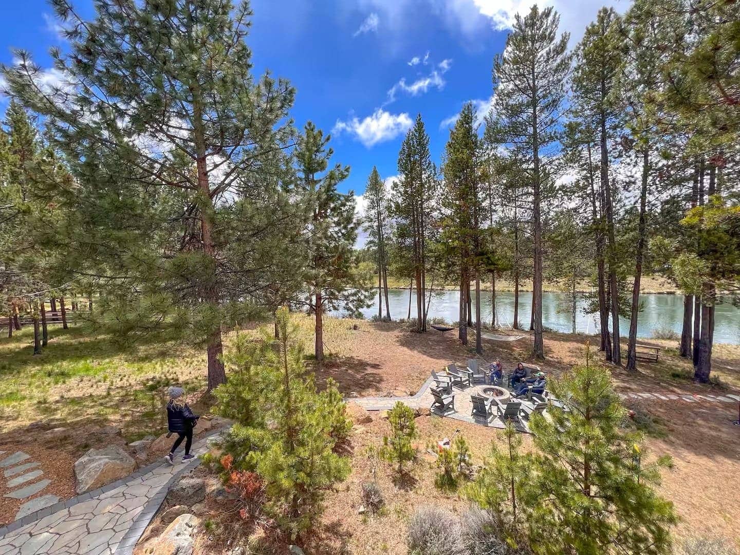
Chief Paulina Drive is a shared dirt road with families and pets, so please drive slowly. The house sits at the end of a dead-end private road. There are 80 acres of trees on one side and protected river habitat across the water. One guest's review below describes the drive in.
The Big River boat ramp, a public put-in, is 2.5 miles up the road. For a full grocery run, Bend has Costco, Trader Joe's, Whole Foods and Newport Avenue Market, about 30 minutes away. Stop there on the way in. Restaurants are in the where to eat guide.
Winter roads to Sunriver: the chain law, TripCheck and the passes
Oregon's chain law applies to all highways in the state, and signs tell you when it is in force. When signs say so, you must have chains or traction tires in or on your vehicle. Vehicles rated at ten thousand pounds gross weight or less may use traction tires in place of chains, unless they are towing. Qualifying four-wheel and all-wheel-drive passenger cars that are not towing are exempt if they meet the listed conditions. Ignoring the signs is a class C traffic infraction.
Traction tires are studded tires, retractable studded tires, or tires that meet the tire industry's severe-snow definition. Tires with the mountain and snowflake emblem are one example. Studded tires are legal in Oregon only from November 1 through March 31. In a conditional road closure, ODOT can require chains on nearly every vehicle, whatever its tires. Staff are usually on site to advise drivers.
Check your whole route before leaving; that is ODOT's own advice. TripCheck.com has the road conditions map, cameras, NOAA forecasts, text reports and the chain law pages. By phone, dial 511, or 800-977-6368 if your carrier does not support it; from outside Oregon call 503-588-2941. It reads conditions by highway, in mountain passes and in major cities, and chain requirements are a main menu option.
| Pass | Highway | Elevation | Snow |
|---|---|---|---|
| Santiam Pass | U.S. 20 and Highway 126 | 4,817 feet | About 450 inches a year |
| Willamette Pass | Highway 58 | 5,128 feet | About 430 inches a year at Willamette Pass Resort |
| Government Camp, Mount Hood | U.S. 26 | 3,891 feet | 232.5 inches a year, 1991 to 2020 average |
| Stinkingwater Pass | U.S. 20, east of Bend | 4,848 feet | Not stated on the page opened |
ODOT's winter maintenance is plowing, sanding and applying anti-icing liquid and salt. How fast a road clears depends on the severity and duration of the storm and on staff resources. Closer in, Mt. Bachelor is about 30 minutes from the house and about 22 miles west of Bend. Skiing and snowboarding usually run from mid-November through the end of May, weather permitting. The resort lists opening day for the 2026-27 season as December 4, 2026.
An Oregon Sno-Park permit is required to park at designated Sno-Parks, the winter recreation parking areas. The permit is required from November 1 to April 30. It costs $4 for a day, $9 for three days or $25 for the year, and parking without one may bring a $30 fine. Permits are sold online through the DMV and by agents at resorts and sporting goods stores. Snow weekends book up early, so read the ski trip page first.
Arriving at the house near Sunriver: check-in after 4:00 PM and parking for 15
Check-in is after 4:00 PM and check-out is before 11:00 AM. Early check-in and late check-out cannot be guaranteed and depend on other reservations. After your booking is confirmed, a copy of a driver's license and a signed rental agreement are required. Guests must be 30 or older to rent.
There is parking for up to 15 vehicles on site, with plenty of room for vans and trailers. Exterior security cameras cover the driveway and front door only, and there are no cameras inside the home. Shoes come off inside. Quiet hours run 9:00 PM to 8:00 AM, which matters for a late arrival with 30 people.
The rooms, beds and floor plans are on the whole estate page. For questions on the way, use the contact page or the chat bubble in the corner.
Where to stay in Sunriver: one estate for up to 30, at the end of the road
For a group of 12 to 30, Deschutes Riverfront Retreat is the place to stay in Sunriver. It has 11 bedrooms and 6 baths in about 5,500 square feet on three private acres, with 450 feet of Deschutes River frontage. It sleeps up to 30 with a maximum of 24 adults. The six-bedroom Lodge, with five baths, sleeps up to 18 and can be booked on its own. The five-bedroom Cottage comes only with the whole estate.
One address for everyone means one convoy down Highway 97 and parking for 15 vehicles at the end. Teams on a corporate retreat get two large living areas, a 12-foot dining table and 200 Mbps WiFi. The house is about 30 minutes from Mt. Bachelor, and ski groups can start with the Mt. Bachelor ski trip page. Families gather at the family reunion house, and friends at large group rentals.
Booking direct on this site saves the service fees that Airbnb and VRBO charge. The booking widget on the Book Now page shows live pricing. Peak dates book up far in advance, and snow weekends book up early.
What guests said about the road in and the drive to the mountain
“Scott was a friendly, proactive and attentive host who communicated clearly and quickly. The setting was serene and beautiful. It was the perfect place for a family reunion of all ages. We saw elk and deer as we drove down the long gravel road. Max speed is 10 MPH which is the perfect speed to really notice if there are elk are around! I really appreciated the quality beds, linens, pillows and towels. The house has many views of the Deschutes River. The dock was a favorite place for the kids. The wrap around deck had plenty of quality seating. The smaller house worked great for my sister’s family of 6 adults and one newborn baby. The main house accommodated the rest of my extended family quite nicely! Do be sure to realize that for larger families, the members need to be comfortable sharing rooms with bunk beds. The description and photos are 100% ACCURATE!”
“Our family enjoyed the house very much. It was at a dead endstreet, so was really quiet. If we had questions, Scott was available and responded pretty quickly. There was plenty of things for our grandkids to do. Would go again.”
“Beautiful property! Our group went for a ski trip so we appreciated the proximity to the mountain, and the houses amenities like the fire pit and hot tub. Kitchen was open and spacious, fully stocked with cooking gadgets making it easy to prepare meals for a big group! Plenty of comfortable sleeping spots, and very nice to have the additional quiet space of the cottage. Scott was proactive with communication and easy to work with! We would love to rent the property again in the summer to make use of the large outdoor space along the river— there’s even a frisbee golf course! Highly recommend this stay :)”
Frequently asked questions
What is the closest airport to Sunriver, Oregon?
Redmond Municipal Airport (RDM), the main commercial airport in Central Oregon, 18 miles north of Bend. Alaska, American, Breeze, Delta and United fly there. Nonstop cities listed by the airport include Seattle, Portland, San Francisco, Los Angeles, Burbank and San Diego. Denver, Salt Lake City, Phoenix, Dallas-Fort Worth and Las Vegas are also on the list. The drive from Redmond is south on U.S. 97. Rome2rio puts the airport 33.2 road miles and about 41 minutes from Sunriver Resort.
How far is Sunriver from Portland, and which way do we go?
Rome2rio puts Portland 175.8 road miles and about 3 hours 54 minutes from Sunriver. Take U.S. 26 over Mount Hood through Government Camp to Madras, then U.S. 97 south through Redmond and Bend. Or take I-5 to Salem, Highway 22 to Santiam Junction and U.S. 20 over Santiam Pass to Bend. Hours vary with traffic and weather, so check TripCheck and your map app on the day.
Do we need chains to get to Sunriver in winter?
Oregon's chain law applies to all highways, and signs say when chains or traction tires are required. Vehicles rated at ten thousand pounds or less may use traction tires instead of chains unless they are towing. Qualifying 4WD and AWD cars that are not towing are exempt. Carry chains in winter anyway: in a conditional closure ODOT can require them on nearly every vehicle. Check TripCheck.com or dial 511 before you leave.
Which mountain passes are on the way to Sunriver?
From Portland and Seattle: Mount Hood on U.S. 26, past Government Camp at 3,891 feet, or Santiam Pass on U.S. 20 at 4,817 feet. From Eugene, Willamette Pass on Highway 58 at 5,128 feet. From Boise, U.S. 20 crosses Stinkingwater Pass at 4,848 feet and Drinkwater Pass at 4,212 feet. TripCheck shows cameras and conditions by highway.
What time can we check in, and is there room to park?
Check-in is after 4:00 PM and check-out is before 11:00 AM; early or late cannot be guaranteed. Parking for up to 15 vehicles is on site, with room for vans and trailers. The house is on Chief Paulina Drive, a shared dirt road with families and pets, at the end of a dead-end private road. Drive slowly on the way in.
Can we fly a private plane into Sunriver?
Sunriver Airport (S21) is a public-use general aviation field owned by Sunriver Resort, with a 5,455-foot asphalt runway at 4,164 feet. Its Wikipedia entry lists no scheduled airline service. Ticketed flights use Redmond, which Rome2rio puts 33.2 road miles from Sunriver Resort.
Sources
- Redmond Municipal Airport (flyrdm.com): airlines and nonstop destinations
- Redmond Municipal Airport: contact page (administration office address, Suite 17)
- Wikipedia: Redmond Municipal Airport (main commercial airport in Central Oregon, airlines and destinations table)
- Wikipedia: Redmond, Oregon (only Central Oregon airport with commercial passenger service)
- Wikipedia: Bend, Oregon (airport 18 miles north of Bend, U.S. 20 and U.S. 97, Century Drive to Mount Bachelor)
- Wikipedia: Sunriver, Oregon (about fifteen miles south of Bend)
- Wikipedia: Sunriver Airport (S21, owner, runway, elevation, 2010 operations count)
- Wikipedia: Mount Bachelor ski area (about 22 miles west of Bend; season from mid-November through the end of May, weather permitting)
- Mt. Bachelor (mtbachelor.com): opening day scheduled for December 4, 2026
- Wikipedia: Three Rivers South, Oregon (south of Sunriver, north of La Pine, west of U.S. 97)
- Wikipedia: U.S. Route 97 in Oregon (Bend Parkway expressway, August 2024 realignment, Sunriver expressway, exits 151 and 153, La Pine)
- Wikipedia: U.S. Route 26 in Oregon (Portland to Government Camp, Wapinitia Pass, Warm Springs, Madras)
- Wikipedia: Oregon Route 35 (starts a few miles east of Government Camp at a U.S. 26 interchange; Bennett Pass is on Route 35)
- Wikipedia: Government Camp, Oregon (elevation, snowfall)
- Wikipedia: Oregon Route 22 (Salem to Santiam Junction)
- Wikipedia: U.S. Route 20 in Oregon (Santiam Pass, Sisters, Bend, Burns, Vale, Idaho line, pass elevations)
- Wikipedia: Santiam Pass (elevation, highways, snowfall)
- Wikipedia: Oregon Route 58 (Goshen to U.S. 97 near Chemult, Oakridge, length, popular alternate route for trucks)
- Wikipedia: Willamette Pass (elevation, Highway 58, ski area)
- Wikipedia: Willamette Pass Resort (average annual snowfall 430 inches)
- Wikipedia: Oregon Route 126 (McKenzie River route, Clear Lake, Santiam Junction, OR 242 not plowed)
- Wikipedia: Interstate 5 in Oregon (Eugene, Salem, Portland, Interstate Bridge)
- Wikipedia: Interstate 5 in Washington (Seattle, Tacoma, Olympia, Vancouver, 277 miles)
- TripCheck (ODOT): road and weather conditions map, cameras, forecasts
- TripCheck (ODOT): Oregon chain law
- TripCheck (ODOT): traction tires
- TripCheck (ODOT): minimum chain requirements and conditional road closures
- TripCheck (ODOT): 511 travel information by phone
- TripCheck (ODOT): winter road maintenance
- TripCheck (ODOT): Sno-Park permits (designated winter recreation parking areas, dates, prices, fine)
- Costco: Oregon warehouse list (Bend)
- Trader Joe's: Bend, Oregon store locations
- Whole Foods Market: Bend store
- Newport Avenue Market, Bend
- Rome2rio, Redmond Airport (RDM) to Sunriver Resort (33.2 miles, 41 minutes)
- Rome2rio, Portland to Sunriver (175.8 miles, 3 hours 54 minutes by car)
- Rome2rio, Seattle to Sunriver (341.6 miles, 6 hours 44 minutes by car)
- Rome2rio, Eugene to Sunriver (125.2 miles, 2 hours 43 minutes by car)
- Rome2rio, Boise to Sunriver (328.5 miles, 7 hours 10 minutes by car)